Methane and tectonics
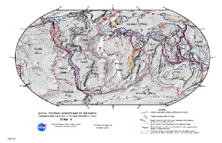
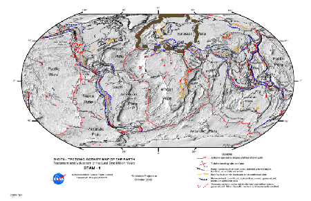
Image on top from NASA via Wikipedia (public domain), the bottom image is a copy, where I outlined a possible plate
Just like the last post was concerned with methane in the nearer Arctic region here a follow up post, which marks out another aspect. Azimuth member Jim Stuttard had pointed out to me an article via the Azimuth Google Plus account (Google plus doesn’t seem to have permalinks to comments so I link to the Azimuth post). The article is from ScienceDaily and decribes:
Methane seepage from Arctic seabed occurring for millions of years.
The researchers argue that:
“This is a deep water gas hydrate system, which means that it is in permanently cold waters and under a lot of pressure. This pressure keeps the hydrates stable and the whole system is not vulnerable to global temperature changes. But under the stable hydrates there is gas that is not frozen. The amount of this gas may increase if hydrates melt at the base of this stability zone, or if gas from deeper in the sediments arrives into the system. This could increase the pressure in this part of the system, and the free gas may escape the seafloor through chimneys. Hydrates would still remain stable in this scenario[IS8] .”
I have some doubts about that stability and I wrote my doubts in the comment and I repost them here:
Are the phase transitions of methane hydrates that well understood that one can assert that the high pressure at the bottom of the sea keeps it stable? May be but then may be not. That is what seems to be behind this assertion is that usually the densest water is at the bottom of the sea at 4 degrees Celcius and then you can then look e.g. at this phase diagram http://en.wikipedia.org/wiki/File:Methane_Hydrate_phase_diagram.jpg
(where I am not sure how well actually these phases had been studied). But then if there is a lot of bubbling going on, then how well applicable is this diagram?
Another thing is their view of the tectonics, the researchers write:
“This means that there is something that activated and deactivated the emissions several times. Plaza Faverola´s paper gives a plausible explanation: It is the movement of the tectonic plates that influences the gas release. Vestnesa is not like California though, riddled with earthquakes because of the moving plates. The ridge is on a so-called passive margin.”
That is I already said here on Azimuth that it may be the case that the tectonics are eventually more active than “passive”. That is I was wondering wether a fault in that region couldn’t be part of “a fault which is a break between the western europe/African plate and the Eurasian/Arabian plate)”. That is if you look at
this map on Wikipedia (which is also above in small), then you see that the tectonics along what seems to be the Ural mountains
may be part of a (in the map nonexisting) “fault” which goes down to the Arabic fault, i.e. the part between african and arabic plate. The map is from 2002 and I tried to find a more up-to-date image but the server at NASA seems currently down. Above I outlined the plate which you get if you consider that break, where the break through the mediteranian seems also not clear, so that plate might eventually include the african plate.

